Back in the day, investing from a distance was tough. It was hard to get a good feel of the area, the property, and the city unless you got in a car (or plane!) and traveled there.
But thanks to technology, today, it doesn’t matter where you are — you can get an up-front and personal view of a property without ever leaving the comfort of your own home. And the best part? It doesn’t cost a penny.
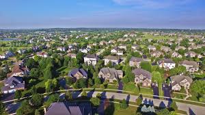
Google Earth is one of the most useful pieces of technology to hit the real estate investing world in the last century. It gives you the ability to really get a handle on a property and area before you invest — which can save you a ton of time, energy, and cash in the long run.
Let’s take a look at some of the best Google Earth (and Maps!) tips for out-of-state real estate investors:
Take a Trip Down Memory Lane
One of the coolest features on Google Earth is the ability to go back in time and see what a property looked like six months ago, a year ago, five years ago, ten years ago… You get the picture.
This comes in handy when you want to make sure you’re getting the most accurate information about a property’s history. I remember when there was a rise in water elevation due to heavy rainfall in the DFW area, people were trying to pitch their homes as lake houses! It was ridiculous.
As an out-of-area investor, you’d have no way of knowing that “lake house” is just a house stuck on a piece of land with rising water levels. But thanks to Google Earth, all you have to do is take a trip down memory lane to see the history of the property — and save yourself from investing in a “lake house” that is nothing but trouble.
Get an Idea of Future Highway Construction
Another cool feature of Google Earth is the ability to see how neighborhoods are changing and how streets and highways are being constructed in real time. And as a real estate investor, that’s helpful information to know.
When you can visualize highway construction and see where new streets are coming in, it helps you to anticipate new construction and development — which can have a direct impact on the value and pricing of your property.
Get a 360-Degree View of the Property and the Surrounding Areas
You may think you’ve found the perfect property — but if it’s not in the perfect area, you can find yourself with a property that puts you in the red instead of building your wealth. Luckily, Google Earth gives you a 360-degree view of not only your property, but also the surrounding areas in every direction — which will give you a heads-up for any potential red flags that could jeopardize your investment.
For example, I had a friend who, years ago, was moving to a new area and bought an apartment he thought was perfect… until he moved in and realized he was directly downwind from the local landfill.
Too bad Google Earth wasn’t around to get him out of the (smelly) situation.
To get access to a view of your property and the surrounding areas, just type the address into Google Earth and use their “street view” feature.
Use the Ruler Tool to Approximate Lot Dimensions
You can’t always trust what you read. You might get information that a lot is a certain size, only to buy it and then realize those numbers were WAY off — and you’ve got a lot significantly smaller than what you were expecting.
Google Earth has a great measurement tool (you can find it on the menu bar by going to Tools > Ruler) that allows you to get a measurement of the lot dimensions. Now, keep in mind, this won’t be precise to the inch — but it will give you a great ballpark figure of how big of a lot you’re dealing with.
Use Maps for… Well, Pretty Much Everything
Google Earth is an amazing tool for investors — but so is a little feature called Google My Maps.
With Google My Maps, you can map out the boundaries of each neighborhood in a city, drop markers for every potential property you’re interested in, color code each property and tag each with individual notes, map driving routes to key areas in the city… Seriously, there’s not much you can’t do with this tool.
This is awesome for out-of-state investors because it gives you a way to group together all your research on a map — and then access that map (and all the information you’ve collected) when you’re on the ground looking at properties.
For a more in-depth explanation on how to use Google My Maps for out-of-state investors, check out this helpful article from OutOfStateInvestor.com.
Buying an investment property when you’re not in the physical area can be challenging — but thanks to Google, things have become a whole lot easier.
See original at: https://www.leapdfw.com/blog/google-earth-tips-for-real-estate-investors/